Researh-and-Production Company “GRIS” developed a Automation Geoinformation System for telecommunication operators with achievement of essential resource saving aim.
Geoinformation System of Fiber-Optical Network Engineering is developed specially for telecommunication companies’ needs and combines its best features of GIS, engineering systems, automation systems of accounting and documentation.
GIS “Fiber-Optical Network Engineering” provides multilayer approach to network handling:
-
Level of network topology (spatial layout and attributes of cables, optical buffer tubes, etc.).
-
Level of network logical connectivity (fibers tracing).
-
Level of allocation services on switches’ ports.
Advantages of the system implementation:
- Improvement of the telecommunication networks quality documenting.
- Essential increase of technical staff work speed due to the information technological processes automation.
- Decrease in labor input of decision-making processes by managers due to spatial analysis of the linear infrastructure.
- Increase of the technical staff and management learning curve due to the information on network availability for staff (according to their access rights).
Brief description:
System GIS «Fiber-optical networks» allows to work both with representations of the linear infrastructure having a spatial binding, and with the equipment placed on a technological platform (the client, etc.). Intuitively clear interface allows creating and modifying objects of telecommunication networks schemes.
Means of the equipment module description allow carrying out certification of network devices to the level of ports. The module of optical buffer tube certification, intended for documenting and the analysis of internal connections by the means of the graphic interface is especially interesting.
Connectivity of a network is supported irrespectively of whether you work with representation of a network linear infrastructure or equipment.
By means of the tool of network tracing you can track how signal extends by setting an initial fiber or device port, and then to see tracing result in the form of scheme which is generated automatically.
Fragment of the system GIS “Fiber-optic network.” Basic functions.
Phone sewage
Cable network
Optical muff
Equipment
Manuals and registries
Screen GIS system “Fiber-optic networks” in solving various problems.
Scheme telekommunykatsyonnoy sets plans for the city.
Optical coupling scheme 1.
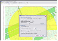
Search is not soldered fibers at a given radius.
Search connectivity.
Administration module (right).
Optical coupling scheme 2.
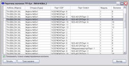
A list of fiber-optic fibers at the platform.
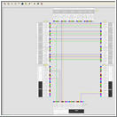
Schematic on the technological platform.
Printing module.
Tracing.
Tracing Scheme 2.
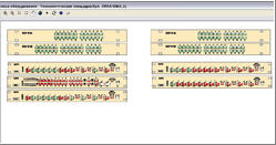
Description of the equipment on the technological platform.
Tracing Scheme 1.
Advantages of the system implementation:
Improvement of the telecommunication networks quality documenting
Essential increase of technical staff work speed due to the information technological processes automation.
Decrease in labor input of decision-making processes by managers due to spatial analysis of the linear infrastructure.
Increase of the technical staff and management learning curve due to the information on network availability for staff (according to their access rights).
Our services:
Moreover, we offer the complex decision of telecommunication network certification of your organization. Our operators will bring the primary information in the shortest terms, simultaneously training your staff for the subsequent support of the system that will considerably accelerate full system implementation.
Functionality of the system can be expanded according to your requirements.
Contact person – Lunkov Vladimir, 38 044 501 4074, lunkov.vladimir@gmail.com, gis@gris.com.ua
Q&A:
Q: What kind of cartographical materials are needed to start the work over?
Q: Do you perform installation on server and system adjustment?
A: Bitmapped graphics and vector maps (layers) can be used as a cartographical bottom.
Vector map is better.
Minimal and sufficient layers set are:
- Blocks;
- Streets;
- Buildings.
A: Yes, of course. Installation on server and system adjustment inclusive.
Q: What could you advice for efficient system handling?
A: We can advice our customer to install a system under the Microsoft Windows Terminal Server. There are many advantages in this approach.
Q: Do you have a support service?
A: Yes, it is determined by contract conditions. As a rule, 6-months system support inclusive.
Q: How to receive presentation materials or demo-version to get acquainted with GIS “Fiber-Optical Network Engineering” facilities?
A: Please contact Mr. Lunkov Vladimir by e-mail: gis@gris.com.ua or, tel. 38 044 501 4074. We can suggest you demo-rolls and remote access to demo-version.
Our Customers:


